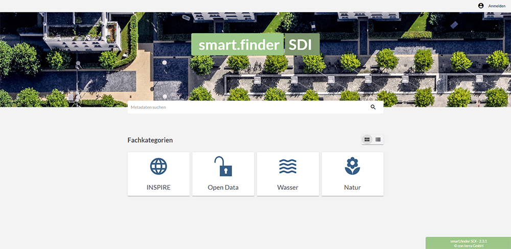
smart.finder SDI

smart.finder SDI offers an unusually powerful and scalable metainformation system based on open standards. Its perfected user-navigation system makes it surprisingly easy to use. Never before has it been possible to collect and provide georesource metadata so effectively and intuitively. As a search engine for intranet and Internet, it makes child's play out of obtaining targeted access to often widely distributed geoinformation resources within public and corporate spatial data infrastructures.
Features

Collect. Organise. Publish. Document
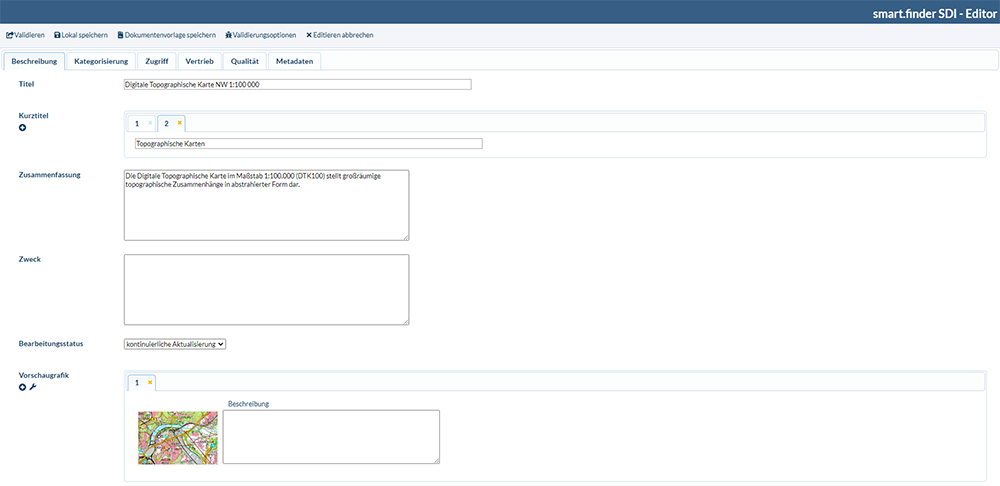
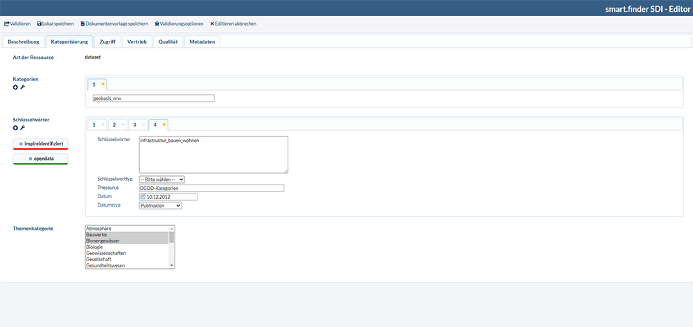
smart.finder SDI supports metadata search and management using intuitive web editors. Simple input masks, a clear structure, and powerful contextual help turn this application into a first-class choice of metainformation system. Its broker and harvesting functions enable external catalogues and data sources to be incorporated into the metadata search. Users can also expose their own metadata to external users via standardised interfaces. Expand public and corporate GIS intuitively and efficiently by adding a central metadata information system, and link with external metadata catalogues on the basis of open standards.
From collection tool to data portal
Thanks to its numerous modification options, smart.finder SDI is perfectly suited for any user scenario. Just about every conceivable use can be easily and quickly configured, from a metadata collection component to a fully featured metadata portal – including interconnection with other metadata catalogues and elegant integration with the ArcGIS system from Esri. In conjunction with the product option 'Connector for ArcGIS', for example, services and datasets found in the search can be opened and used directly in ArcMap. Moreover, connections are available for numerous map viewers and portal clients that enable direct handover and visualisation of the found map services.
INSPIRE-compliant and ISO-compatible
Naturally, smart.finder SDI satisfies the requirements arising from INSPIRE Directive 2007/2/EC of the European Parliament and Council for the creation of a spatial data infrastructure within the European Community (INSPIRE). It provides the interface of the INSPIRE Discovery Service, offers all INSPIRE metadata elements necessary for collection, validation, and results display, and supports all the search elements defined by INSPIRE. It enables derived metadata views based on any desired ISO elements as well as modification to other ISO profiles.
Feature Profile
Web-based collection, validation and publication of metadata in accordance with ISO and INSPIRE
Supports OGC Catalog Service CSW 2.0.2, ISO Metadata Application Profile 1.0 and DE Profile 1.0.1
Configurable metadata views/ISO profiles
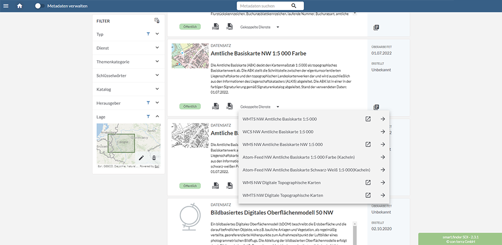
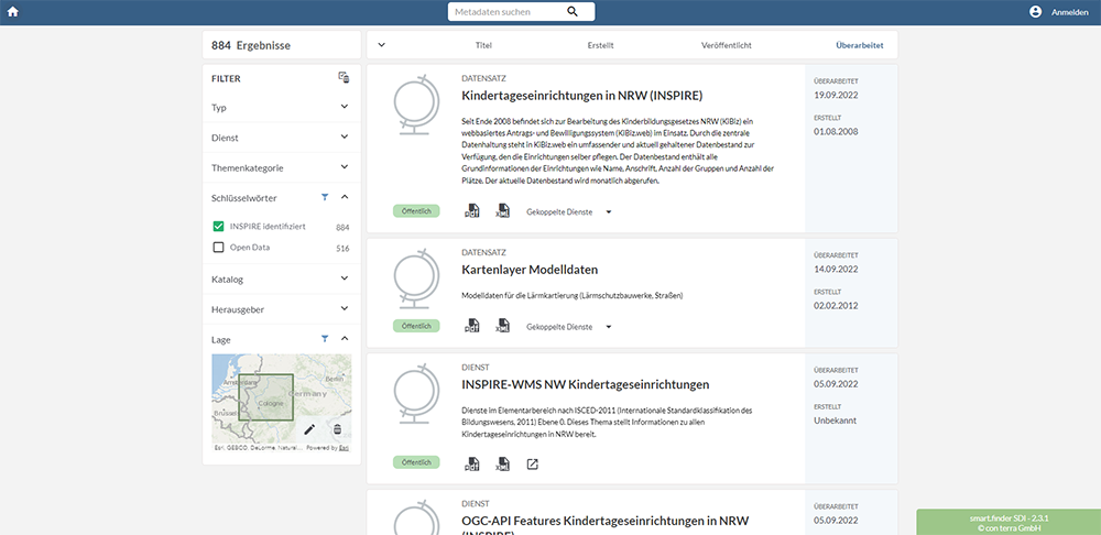
Searching possible using thematic, temporal or spatial search criteria
Spatial searching using map window (WMS) and Gazetteer (WFS)
Freely configurable theme browser
Connection to GEMET thesaurus
Broker functionality including caching
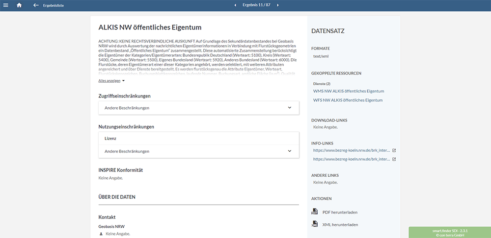
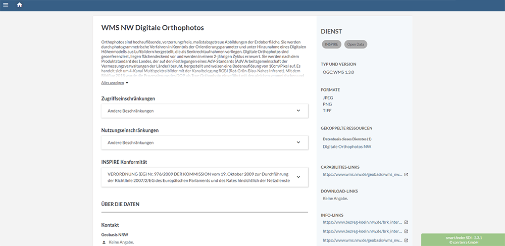
Detailed metadata display with graphical preview
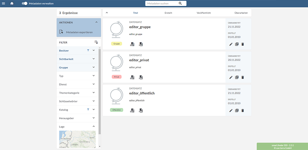
Workflow management for metadata publication on the basis of user roles and approval status
Barry Masterson