Leadership TransitionNew management team to take over on July 1, 2026NewsDiscoverDigital TwinsMoreDigital TwinsDisaster ManagementDigital TwinsMonuments What's New Find out more about con terra's current events, projects and solutions and discover exciting topics related to geoinformation, digital transformation and innovative technologies. Technology Discover GeoAI Make smarter decisions with artificial intelligence! Find out more Events Meet us Meet our experts at trade fairs, congresses and user conferences. Meet us Case Study The QA app of Bayerische Forstverwaltung con terra has developed a powerful and flexibly adaptable quality assurance workflow for Bayerische Forstverwaltung that breaks new ground by decoupling the specialist department from the development department. Find out more get to know con terra About us Our success is based on passion and enthusiasm, resting on a solid foundation. This foundation is formed by our employees. Find out more security.manager Superpowers for GIS Admins Imagine being able to do all your routine tasks at the speed of sound, suddenly being able to achieve much more in the same amount of time than before. Wouldn't that be the perfect superpower for you as a GIS Admin? Find out more
28.07.2026 Insights for FME With Insights for FME, you can analyze, document, and monitor workspaces, automations, database and web connections, and runs—all in one central location. learn more Read more about Insights for FME
28.07.2026 Insights for FME With Insights for FME, you can analyze, document, and monitor workspaces, automations, database and web connections, and runs—all in one central location. learn more
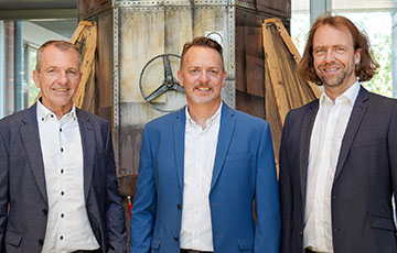
03.07.2026 Generational Change at con terra Effective July 1, 2026, after more than 17 successful years, Karl Wiesmann and Uwe König handed over management responsibilities to Christian Elfers, Christian Heisig, and Christian Sehlleier. learn more Read more about Change in Management
03.07.2026 Generational Change at con terra Effective July 1, 2026, after more than 17 successful years, Karl Wiesmann and Uwe König handed over management responsibilities to Christian Elfers, Christian Heisig, and Christian Sehlleier. learn more
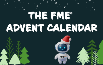
26.11.2025 The FME Advent Calendar The Pre-Holiday Trivia Challenge is starting. learn more Read more about The FME Advent Calendar 2025