Vodafone
Automated Processing of Mobile Network Geodata

The Challenge
Mobile networks, like Vodafone’s, consist of individual cells whose coverage depends on geographical conditions, distance between the sites, cell height, orientation and used antenna types, transmission power, and the mobile communication standards applied. To carry out smooth network operations, necessary maintenance work, and many other business processes, Vodafone requires reliable, highly up-to-date, and comprehensive geoinformation on the network status.
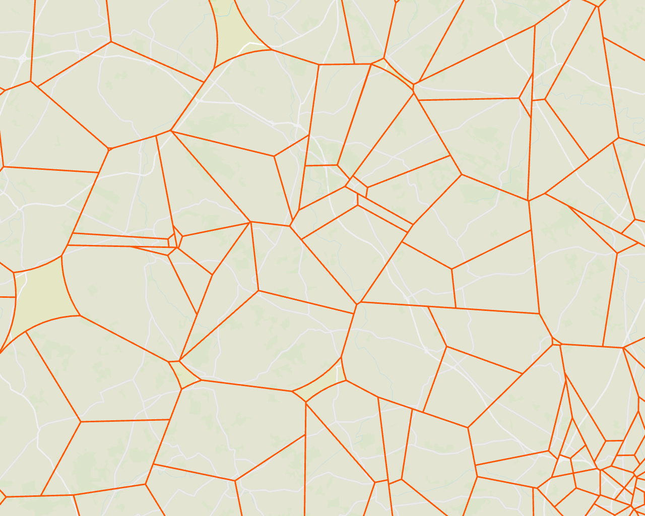
The challenge was to implement a process that, based on continuously updated data from different systems, automatically triggers a daily calculation of idealized cell areas. The generated cell areas then need to be combined with further technical information and provided to various specialized tools – in the appropriate form and required format. Furthermore, the solution had to be future-proof and allow new technologies and network standards to be integrated timely and easily.

Every five seconds, a Vodafone mobile customer in need of assistance uses the emergency call 110 or 112. The developed solution helps us to route emergency calls quickly and reliable to the responsible emergency call center. This is realized by constantly updated geo-information, which even contains information on mobile network cells that were taken into operation recently.
Sven Kornetzky - Team Leader TGUR - Routing & Roaming - Vodafone GmbH
The Customer
Vodafone is one of the leading communications companies. One of every two Germans is a Vodafone customer – whether for internet, telephone or television; whether they connect their office, farm, or factory with Vodafone technology. As a digitalization partner of the German economy, Vodafone counts start-ups, SMEs, and DAX-listed companies among its clients. No other company in Germany connects more people and machines via its mobile network. With over 30 million customers for cellular, almost 11 million for broadband and more than 13 million for TV, as well as numerous digital solutions, Vodafone Deutschland with its roughly 16,000 employees generates total annual revenue of about 13 billion Euro.
The Solution
With the ability to provide data integration processes as services within the company, FME Server forms the base component for the solution at Vodafone. Continuously incoming data from network documentation and planning processes are collected via different system interfaces to calculate daily cell areas in a nightly running process. The subsequently enriched data with technical information are provided by FME Server, depending on the requirements of the consuming system, in different (geo-)formats, for Esri based clients, for example. A special feature are the requirements for emergency call routing. With the ability to provide information for newly created cells during the day, up-to-date information can also be provided on an event-driven basis. The combination and processing of the data serve as a basis for answering various technical questions related to Vodafone’s mobile network.
The Benefits
Reliable and current: The geo-information about the current state of the mobile network which is generated by FME Server serves as an essential basis for many, often critical, use cases related to Vodafone’s mobile network. Examples include emergency call routing, customer information in case of network faults, user warnings via cell broadcasts, and a multitude of other business processes. FME Server supports both the daily automated calculation and the event-driven provisioning of mobile geodata at shorter intervals for critical business processes.
The solution is based on

FME Server (incl. technical configuration and project-specific extensions)
Oracle Spatial Database
Python
Summary
Automated, up-to-date creation of essential mobile network geodata from Vodafone via FME Server technology.
Calculation of idealized cell areas for all operationally used mobile communication technologies and frequencies.
Integration of different data sources and interfaces to bring together relevant information.
Optimized provisioning of geodata and derived information via database and data interfaces for numerous applications.
Easy integration of new mobile communication technologies.
Simple expansion of data deliveries for new use cases.
Complete integration into Vodafone’s system landscape

Thomas Vieth