
ICRC and INSER
Geoportal of the International Red Cross
The Challenge
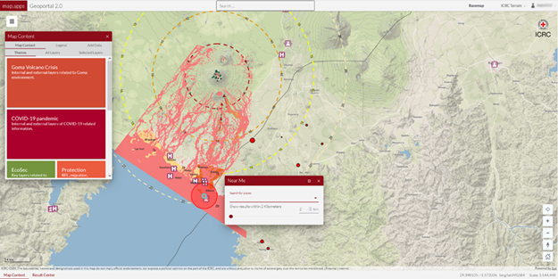
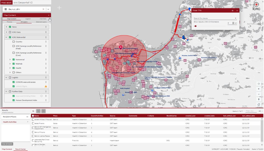
Since 2003, the International Committee of the Red Cross (ICRC) has had a GIS infrastructure to support the work of ICRC delegates in the field. In 2020, it was decided to fundamentally overhaul the geoportal that had been in place since 2011. The aim was to create a central and modern platform for the provision of all available geodata and web-based geo-resources. The challenge was to organise the more than 170 layers of information in such a way that they can be queried, overlaid, designed and interconnected in an efficient and user-optimal way. The data sets used are diverse. They concern accessibility, important services such as hospitals or power plants, as well as prisons and all places, where the organisation’s teams are active or could become active.

The ICRC Geoportal 2.0 is the gateway that brings together data from different sources: external data, data managed by our geodata team and staff, data from the different internal data warehouses and all data stored on ArcGIS Online. The easy-to-use application allows users to overlay multiple layers and shape them as needed.
The Project Participants
ICRC
The International Committee of the Red Cross (ICRC) is the largest humanitarian network in the world. Its mission is to alleviate human suffering, protect life and health and uphold human dignity, especially in armed conflicts and other emergencies. The movement is present in all countries and is supported by millions of volunteers.
With around 20,000 staff in more than 100 countries, the organisation provides humanitarian aid to people affected by conflict or situations of armed violence.
INSER
INSER is a Swiss company based in Lausanne. As a long-standing partner of con terra, Esri and Safe Software, INSER specialises in the development of applications and the processing of geodata. The company employs around 20 people.
The Solution
The ICRC's new geoportal is a map-based information and analysis application based on map.apps, which takes advantage of Esri's ArcGIS API for JavaScript. The data and services infrastructure is provided by ArcGIS Enterprise. In addition to the configuration of existing widgets, further customisation has developed the exact tools that enable the ICRC GIS team to provide users with a user-friendly and highly functional geoportal.
In addition to special search and query options, there is also the possibility to change the symbology of the data in the browser-based map app "on the fly". The map.apps ETL extension is also used for interactive loading and exporting of data. Individual access rights to the data and services used are made possible via the security.manager.
In future developments, the geoprocessing and analysis capabilities of the platform will be extended by means of the map.apps ETL extension.
The Advantages
modern WebGIS application
central application for all geoinformation
convenient search options and easy access to geo-resources
Esri technology based on the ArcGIS API for JavaScript 4
integration into and interaction with existing ArcGIS Enterprise and ArcGIS for Portal infrastructures
The Technology
map.apps / map.apps ETL
security.manager
FME
ArcGIS Enterprise
Summary
Under the leadership of the Lausanne-based company INSER, con terra played a decisive role in the realisation of the Geoportal 2.0 for the ICRC GIS team. In this context, con terra contributed components of the solution portfolio and took on project-specific adaptations and development work based on the products used.