Utilities
Manage Infrastructures Securely and Reliably
With perfectly tailored GeoIT solutions from con terra, you always have an up-to-date overview of your network infrastructure. We support you in planning, implementation, operation and integration into your business systems. With the resulting digital twin, planning and operational processes can be easily automated, enabling efficient operation of network infrastructures.
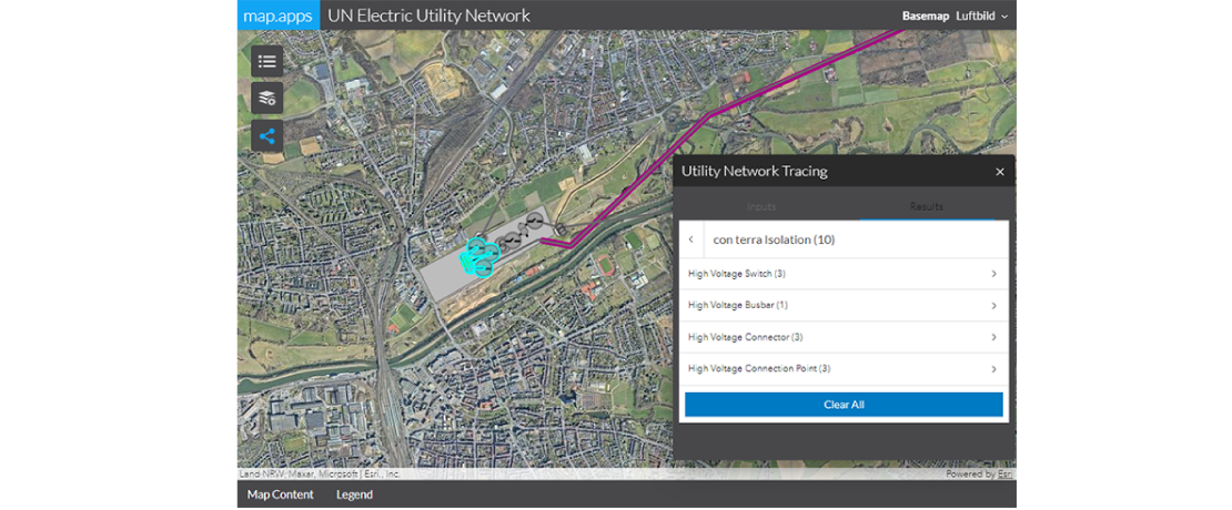
The ArcGIS Utility Network from Esri forms the powerful basis for their solution and at the same time enables easy integration into all applications of the Esri product range. con terra is one of only a few certified Esri partners worldwide who have the necessary expertise regarding the deployment of and migration to Utility Network.
Our Services
Consulting and Concepts for Customized GeoIT Solutions
Requirements analysis and system recommendations
Advice on component lifecycles and their dependencies
Support in planning and definition of process models
Advice on the secure operation of the overall solution
Design and Implementation of Automated Data Processes
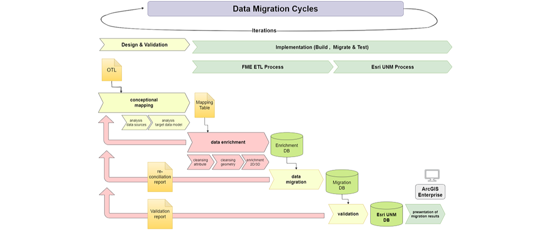
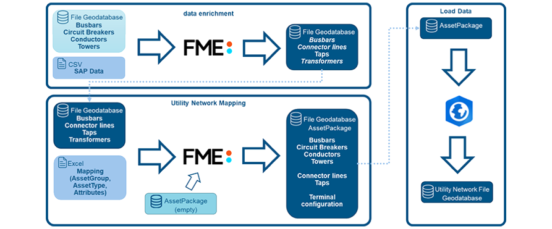
Transition of network data from legacy systems
Automated completion of missing attribute and geometry information for model-compliant data storage
Design and implementation of data quality gateways
Development of service interfaces to additional business systems
Implementation and Operation of Customized Network Information systems
Development of user-oriented and effective information systems using UCD and UX methods
Focus on operational reliability and sustainability
Use of our proven technology stack consisting of ArcGIS, FME and con terra technologies
Operation or operational support, support and maintenance of the resulting solution
As Esri Platin Partner, awarded with the Esri Network Management Specialty, and Safe Software Platin Partner, we meet your requirements with great expertise and look forward in creating perfect solutions together with our coustomers.


