
smart.finder SDI – Fast, easy, and standards-compliant
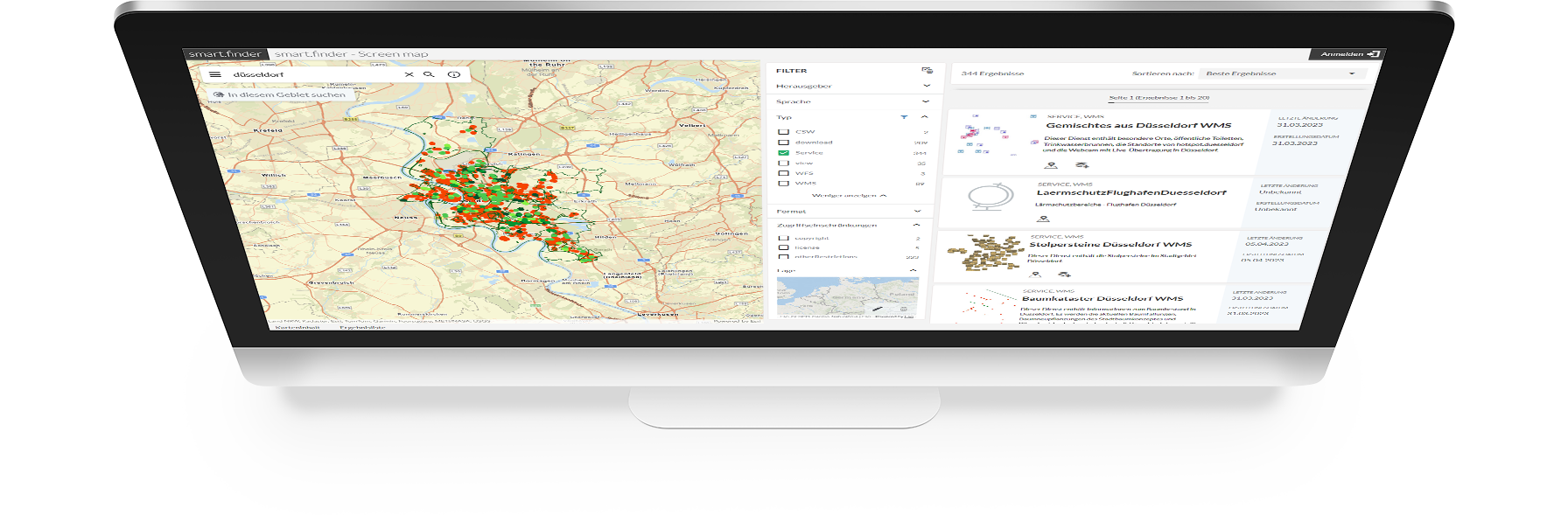
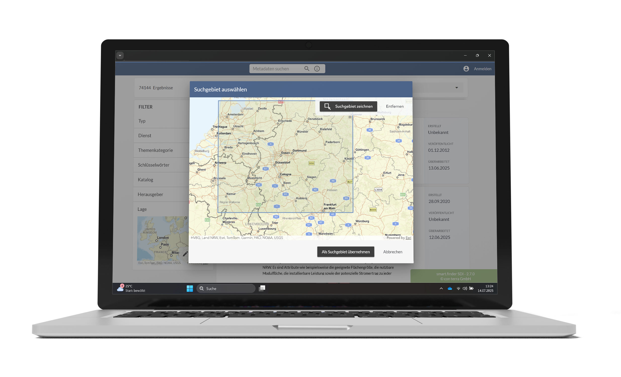
smart.finder SDI offers an unusually powerful and scalable metainformation system based on open standards. Its perfected user-navigation system makes it surprisingly easy to use. Never before has it been possible to collect and provide georesource metadata so effectively and intuitively. As a search engine for intranet and Internet, it makes child's play out of obtaining targeted access to often widely distributed geoinformation resources within public and corporate spatial data infrastructures.
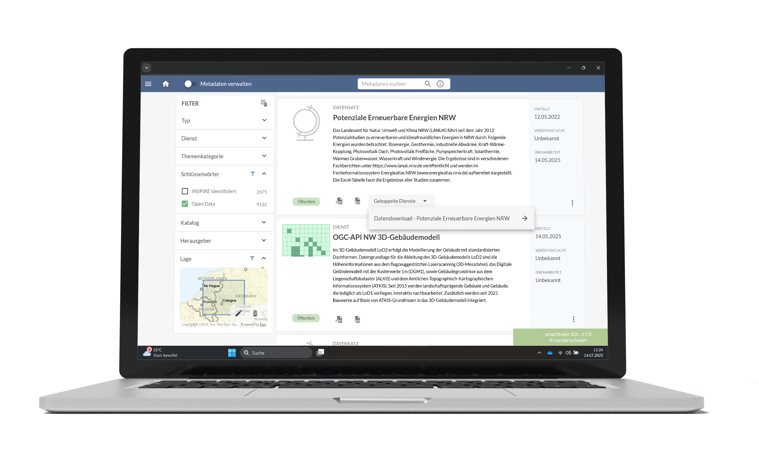
With an intuitive entry screen, intelligent context help and flexible validation options, smart.finder SDI simplifies the documentation and retrieval of your geoinformation. Powerful harvesting functions enable the seamless integration of external catalogues and data sources. Standardised interfaces make it easy to share metadata with external users – for maximum efficiency and networking.
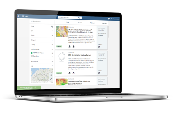
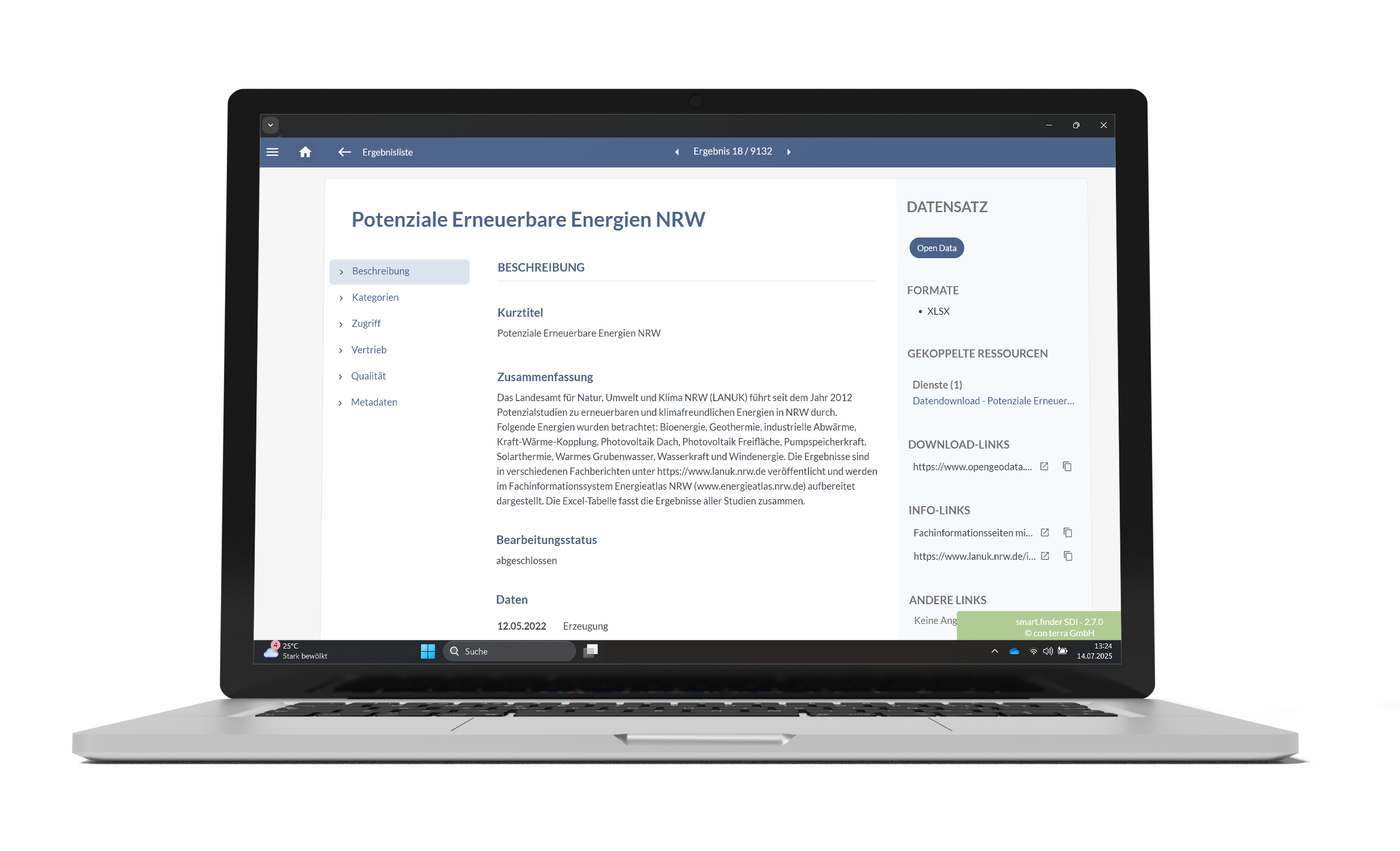
smart.finder SDI enables both metadata capture and the creation of a metadata portal. Networking with other metadata catalogues is easy to implement thanks to individual configuration. Researched display services can be transferred to different map viewers and displayed visually.
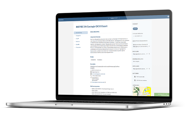

smart.finder SDI meets all requirements of the INSPIRE Directive, the GDI-DE conventions and ISO standards, and provides the INSPIRE Discovery Service interface. It offers all relevant INSPIRE and GDI-DE metadata elements for capture, validation and display, and also supports specially defined search elements. This ensures compliance with international geodata standards in a simple and efficient manner.
- intuitive entry forms with powerful help functions and validation options support users in creating metadata
- central documentation and search of all geodata and services within a geodata infrastructure
- web-based capture, validation and publication of metadata — flexible from a simple capture module to a fully-fledged data portal
- full support for the INSPIRE Directive 2007/2/EC and the GDI-DE Convention on Geodata Infrastructure
- support for ISO standards such as ISO 19115/19119 (metadata) and ISO 19139 (XML encoding) as well as OGC Catalog Service CSW 2.0.2
- quality tested against relevant test suites (e.g. GDI-DE test suite) – ensures compliant metadata quality
- broker and harvesting functionality enables external catalogues and data sources to be included in metadata searches
- flexible configuration from simple capture components to a complete metadata portal, including networking with other metadata catalogues
- connection to map.apps SDI for direct transfer and visualisation of the searched display services.

Distributors

Download smart.finder SDI Flyer (PDF)