
Luxplan S.A.
SIGcom - Local Authority WebGIS for Luxemburg
The Challenge
For the past fourteen years, Luxplan has been advising and supporting several local councils in Luxemburg in setting up and running local-authority-based geographical information systems (GIS). The aim of the project was to comprehensively modernise the municipal WebGIS service, with particular emphasis on the aspects of usability and performance of modern Web 2.0 applications. The overall objective was to devise a replacement for the former system in the form of a modern solution featuring plugin-free, good performance levels, a modern user interface, and the ability to deploy mobile client equipment.

Benefits to users include the simple and clearly laid-out graphical user interface as well as the speed and enhanced freedom of browser operation which enables the application to run on tablet computers, making it available at mobile locations."
The Customer
With more than thirty years of experience behind it, the LUXPLAN engineering company supports its customers with high-quality, professional services combined with comprehensive specialist expertise at all project levels, from the preliminary study to the implementation phase.
The engineering firm operates internationally, offering multi-disciplinary services in the following fields:
Road and railways infrastructures
Site management and project control
Town and country planning
Traffic and mobility studies
Hydraulic engineering and urban water management
Environmental studies
Forestry studies
Surveying
Geographical Information Systems
The Solution
A solution was implemented, based on both the Esri ArcGIS system and con terra map.apps and security.manager. The data storage system was restructured to use the Esri geodatabase, and ArcGIS for Server services was configured to suit the requirements.
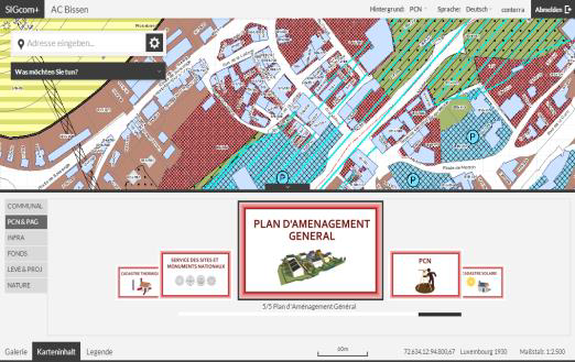
An individual map.apps information solution was configured for each of the forty or so municipalities to ensure the high-performance provision of numerous services and layers. Moreover, these were expanded by adding specific functions, such as extended printing capabilities and CycloMedia integration. Management of the various rights for accessing the diverse range of applications is controlled through security.manager.
The overall solution runs in a managed-services environment hosted by con terra, to which Luxplan possesses dedicated access rights at all times. The first local-authority WebGIS became active in May 2014, after a migration period of only twelve months.
The Technology is Based On
ArcGIS Server and JavaScript API from Esri
map.apps
security.manager
con terra Managed Services Hosting
The Benefits
Users in the various municipalities are now able to access a modern solution that covers a wide range of use cases, from the visualisation and querying of all technical municipal data, to the integration of 360° panoramic images (CycloMedia) and including the ability to collect data by means of web editing.
By enabling content provision to mobile terminal equipment or in special apps, whose functionality is focused on single use cases, more than thirty municipalities are now free to decide what information they themselves wish to provide. The operation and management of the wide range of solutions is made possible by the appropriately oriented architecture of the map.apps solution, which furthermore supports modular and successive functional extensions.
Summary
Modern platform based on ArcGIS, map.apps and security.manager
Fast and successful replacement of the former system
Wide number of municipal use cases accommodated
Simple operation and administration of individual WebGIS applications
Consistent authentication/authorisation concept
Own hardware resources outsourced to a hosting environment
Individual modular extensions can be made to the standard software
