Vodafone
Geodata Management with Geobase

The Challenge
Geodata are a decisive building block for numerous critical business processes in the telecommunications industry. The targeted integration of network provider and infrastructure data, basic geodata or pre-processing data leads to significant gain in terms of information and thereby aids in correct decision-making. In order to optimally support digital business processes, geodata from various sources and in heterogeneous formats must be drawn together into a “single point of truth”.
Especially given this background, processes for generation, provision and storage appropriate to the client’s needs are essential.
In order to ensure availability which is both as broad and effective as possible, two aspects are of particular importance:
- Fast and intuitive search functionality which allows for a targeted search of existing geodata stock.
- A modern, service-based and automated provision architecture which allows for a rapid, simple and needs-oriented distribution of the geodata within the company.

The new application is a decided improvement for geodata users in the scope of the functions available relating to geodata searches. The User-Centered Design approach has helped in the creation of an application that is intuitive to use. The Tool Administrators benefit from transparent processes and increased stability. The modernization is a win, both for users and administrators."
The Customer
Vodafone is one of the leading communications companies. One of every two Germans is a Vodafone customer – whether for internet, telephone or television.
The Düsseldorf-based company provides internet, cellular telephony, landlines and television under one roof. As a digitalization partner for the German economy, Vodafone counts start-ups, mid-sized companies and DAX corporations among its clients.
With over 30 million customers for cellular, almost 11 million for broadband and more than 13 million for TV, as well as numerous digital solutions, Vodafone Deutschland with its roughly 16,000 employees generates total annual revenue of about 13 billion Euro.
As a gigabit company, Vodafone drives the expansion of infrastructure in Germany forwards: Today, Vodafone reaches over 24 million households with its nation-wide fiber optic cable network, of these around 23 million with gigabit speed. With its 4G network, Vodafone reaches more than 99% of all households in Germany. Vodafone’s machine network (narrowband IoT) for industry and business is accessible to nearly 97% of Germany’s geographic territory. Since the middle of 2019, Vodafone has begun operating the first 5G network in Germany, reaching over 25 million people.
The Solution
Using the methods of User-Centered Design (UCD) and in collaboration with the stakeholders, the concrete requirements for the geodata were identified and the concrete applications were derived. These were implemented in prototypes with optimized, application-oriented usability, and finally evaluated by Vodafone employees.
What came out of this was two focused web applications based on the software framework map.apps from con terra, already in use at Vodafone.
- With the Management App, all geodata are recorded and described in a standardized internal Vodafone format. The app serves to determine the further provision of the geodata, as well as to administer its automatic distribution.
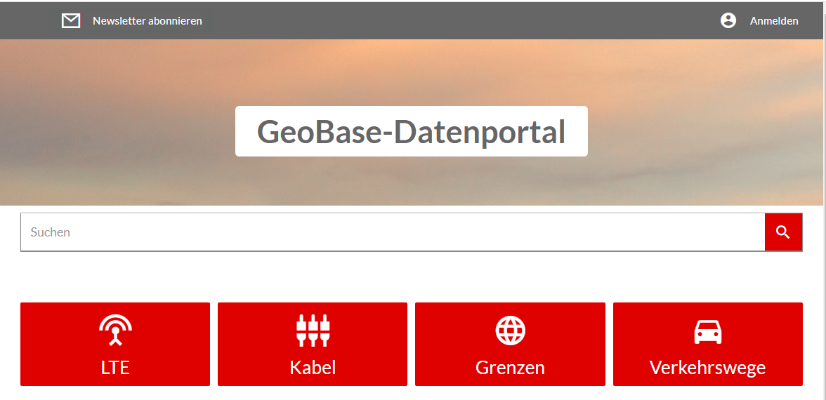
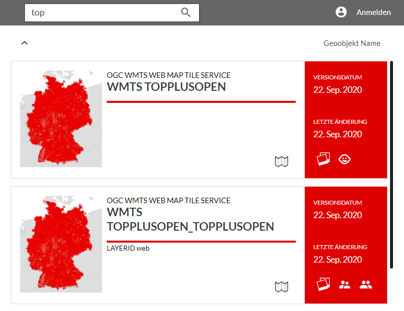
- The Research and Information App, available to all employees, makes possible a simple, high-performance search of the entire geodata pool. Results provide the user with the most important information on the geodata found in an easy-to-use form and offer corresponding, context-related next steps. Furthermore, the use can either load the data as a map service into their application, or request them as a download, for which both format and coordinate transformations are possible.
The Solution is Based On
map.apps: application framework for geodata management and research
FME Server: business logic for processes geodata
ArcGIS Server: provision of geodata as map services and service-based GIS functions
Oracle DBMS: storage of geo-metadata
security.manager: securing of services, rights and roll management
smart.finder: simple, combined key-work search
Spatial UX – User-Centered Design: optimization of usability for the company-wide geodata portal
Summary
Geodata management: focused management app simplifies importing, metadata maintenance and the provision of geodata. The intuitive user controls lead the user quickly to their goal.
Central geodata portal: research and display of geodata for all Vodafone employees. Standardized documentation of the geodata allows for targeted searching and effective deployment for a wide range of applications.
Geodata provision: simple use of all geodata via subscription, download or data service within Vodafone.