Single tree-based, satellite-supported Forest Ecosystem Monitoring
ForestCare
The Challenge
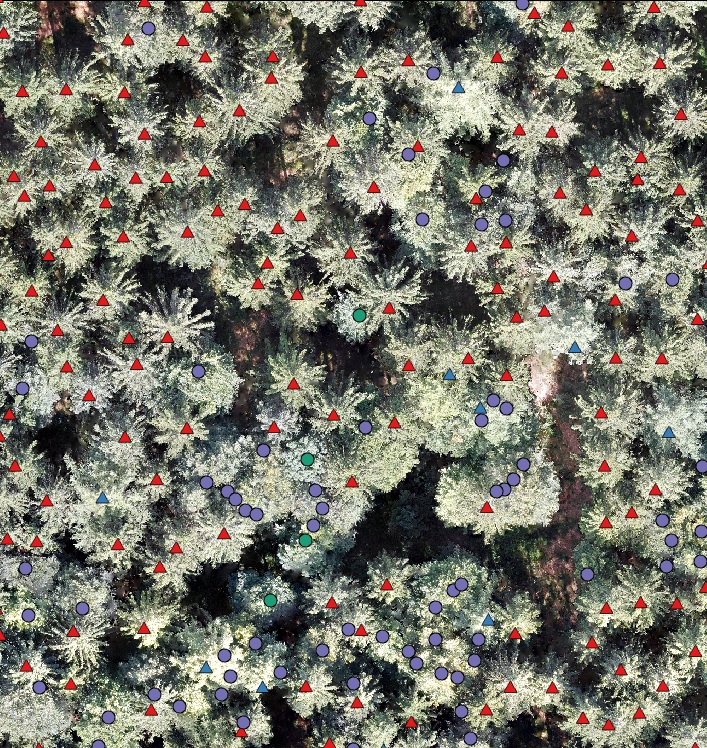
As part of the ForestCare project, drone and satellite image data will be used to identify characteristics of individual trees, such as defoliation, bark beetle infestation or trunk shape. The aim is to assess forest growth at regional level using artificial intelligence (AI) methods and to support reforestation measures in a site-optimised manner.
For the training of the AI, the input data of the drones must be compared with corresponding target data. This requires the development of an extensive, high-quality database that serves as the basis for AI training. Challenges in digital data collection in the forest include the frequent lack of a network connection and efficient handling of the data collection tools, which consist of an electronic clip, a GPS device and a tablet. An intelligent data collection system that simplifies and speeds up data collection by means of voice control, which can also be used without a network connection, is intended to help.
The constructive cooperation in the planning and development phase of the recording app, as well as the involvement of the field teams, was extremely motivating. Thanks to the realised recording app, one of the most comprehensive georeferenced single tree libraries could be built in a short time."
The Customer
Education, research and innovation are the central fields of action for Germany's future. As part of the “Natürlich.Digital.Nachhaltig” [Natural.Digital.Sustainable] action plan, the Federal Ministry of Education and Research (BMBF) is funding digital innovations in environmental technology with the aim of using natural resources more sustainably and reducing environmental pollution. In this context, the BMBF is supporting the ForestCare R&D project via the project management organisation Jülich as part of the funding measure “Digital GreenTech – Umwelttechnik trifft Digitalisierung” [Digital GreenTech - Environmental Technology Meets Digitalisation]. The project is coordinated by Georg-August-Universität of Göttingen, Department of Work Science and Process Technology.
Further information can be found on the project website: www.uni-goettingen.de/de/647748.html
The Solution
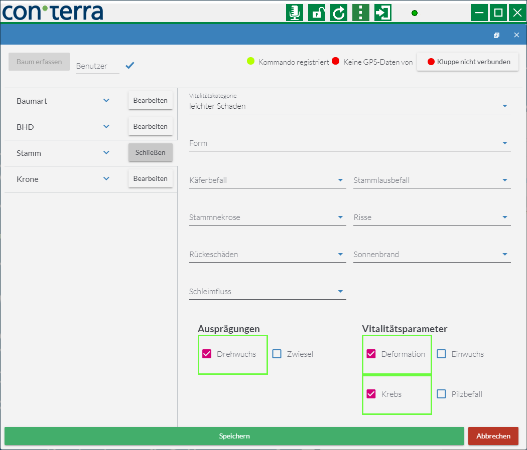
For mobile recording, an AI speech recognition system was developed that runs offline and is adapted to the domain-specific vocabulary. Mappers thus have their hands free during their work and are not forced to switch between measuring and input devices. Acoustic and visual feedback also supports data collection and helps minimise errors.
The speech recognition module was directly integrated into the con terra Technologies based recording app. In addition, the electronic clip and the GPS receiver were directly connected. The recorded tree locations and attributes can be displayed, checked and edited within the app.
The collected data is bundled on a central instance, quality-assured and made available for further use in the project. The language module can be used for further app implementations based on con terra Technologies.
The Benefits
Highly efficient data collection through voice control
Adapted to domain-specific language
Available offline on mobile device
Enables ambidextrous operation of the recording instruments
Continuous, stable workflow
The Technology
map.apps (incl. map.apps Offline, map.apps Speech)
ArcGIS Server
security.manager
Summary
As part of the ForestCare R&D project, con terra was involved in the creation of an app for individual tree recording using voice recognition, which is used to build up a comprehensive AI training database.
Thanks to simple user control, an end-to-end digital workflow, optimised data management and domain-specific, offline-capable language support, a highly efficient solution has been created that allows the database to be built up quickly.