
Federal Supervisory Authority for Air Navigation Service
3D System Building Restricted Areas
The Challenge
The two-stage approval procedure of the International Civil Aviation Organisation (ICAO) lays down the basis for erecting structures in building restricted areas (BRA) around facilities for communications, navigation and surveillance (CNS). In Stage I of the procedure, it is necessary to clarify whether a planned building is able to impair the operation of CNS facilities in any way and whether it isthen necessary to conduct a detailed inspection. In the case of the Federal Republic of Germany, this is regulated by § 18a of the Aviation Act (LuftVG).
By implementing the 3D System Building Restricted Areas project, the BAF is pursuing the objective of expediting this process, facilitating the secure exchange of information between the responsible authorities, and obtaining legal and planning certainty in the shortest possible time for all those involved.

Ever since the web tool for 3D System Building Restricted Areas has been deployed, our employees' workloads have been drastically reduced, allowing them to devote their energies more effectively to their core duties. We also receive positive feedback from our customers because the processing time of their applications is now considerably shorter, in particular when no impairment of a CNS facility resulting from a planned structure can be established."
The Customer
The Federal Supervisory Authority for Air Navigation Services (BAF) was created on 9 August 2009 and is an agency within the Federal Ministry for Transport, Construction and Urban Development (BMVBS). In particular, the BAF works to ensure that civil air traffic control organisations comply with applicable regulations and high safety standards.
Its regulatory function comprises the certification of air traffic control organisations. Moreover, the BAF exercises constant control of all organisations, systems, procedures and individuals deployed in the performance of air traffic control services.
All operating facilities of the air traffic control organisations under the authority's supervision are subjected to regular inspections. Furthermore, the BAF operates an extensive reporting system. This provides an overview of particular incidents as well as any planned changes to the air traffic control system, which is available at any time.
The Solution
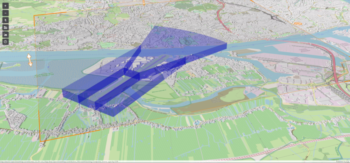
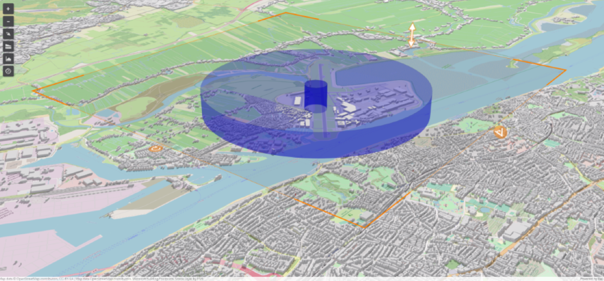
The web solution was implemented on the basis of Esri technology. All BRAs around CNS facilities are calculated three dimensionally and the data is stored in a central enterprise geodatabase. Similarly, planned structures undergo three-dimensional modelling and checked to ascertain whether they are located in building restricted areas, with the aid of 3D overlaying.
Other users of the new GIS application in addition to the BAF include the sixteen state aviation authorities and the air traffic control organisations in Germany. The web-based solution quickly renders clarity as to whether a planned building may possible interfere with the operation of a CNS facility. By entering the spatial coordinates and the height of the building, the administration can quickly determine whether or not a system will be affected. Moreover, users are provided with precise map materials and exact data in electronic form, which is interchangeable.
The Technology is Based On
ArcGIS Server
ArcGIS Desktop
ArcGIS 3D-Analyst
security.manager
The Benefits
The application makes a significant contribution to approval procedures relating to building structures within a CNS facility’s building restricted area pursuant to § 18a LuftVG. This is achieved by means of a statement that can be obtained at short notice through the Internet as to whether or not a structure is located within a building restricted area. In this way, the BAF is promoting administrative modernisation and enhancing the efficiency of administrative activity.
It is expected that up to 2,000 queries per year will be managed exclusively by means of the web tool, significantly reducing the administrative workload of the participating agencies.
A further essential benefit gained from using GIS technology is the improved quality of structural inspections. By means of complete 3D modelling of BRAs and and structures, it is possible to render much more precise statements regarding the potential interference of planned structures than was formerly the case.
Summary
Considerable acceleration of processes in the approval procedure relating to building restricted areas pursuant to § 18a LuftVG
More efficient administrative activity
Qualitative improvement by means of 3D modelling
Improved overview of ongoing processes by means of workflow support from web tool