map.apps Advanced Editing

Efficient data capture
With map.apps Advanced Editing, even demanding data acquisition and editing tasks, previously reserved for desktop systems, can be carried out in the web browser. This product extension expands the functionality of map.apps with special editing tools, providing an optimised user experience for both the acquisition of new and the editing of existing geodata.
Highlights

Comprehensive and convenient geometry acquisition
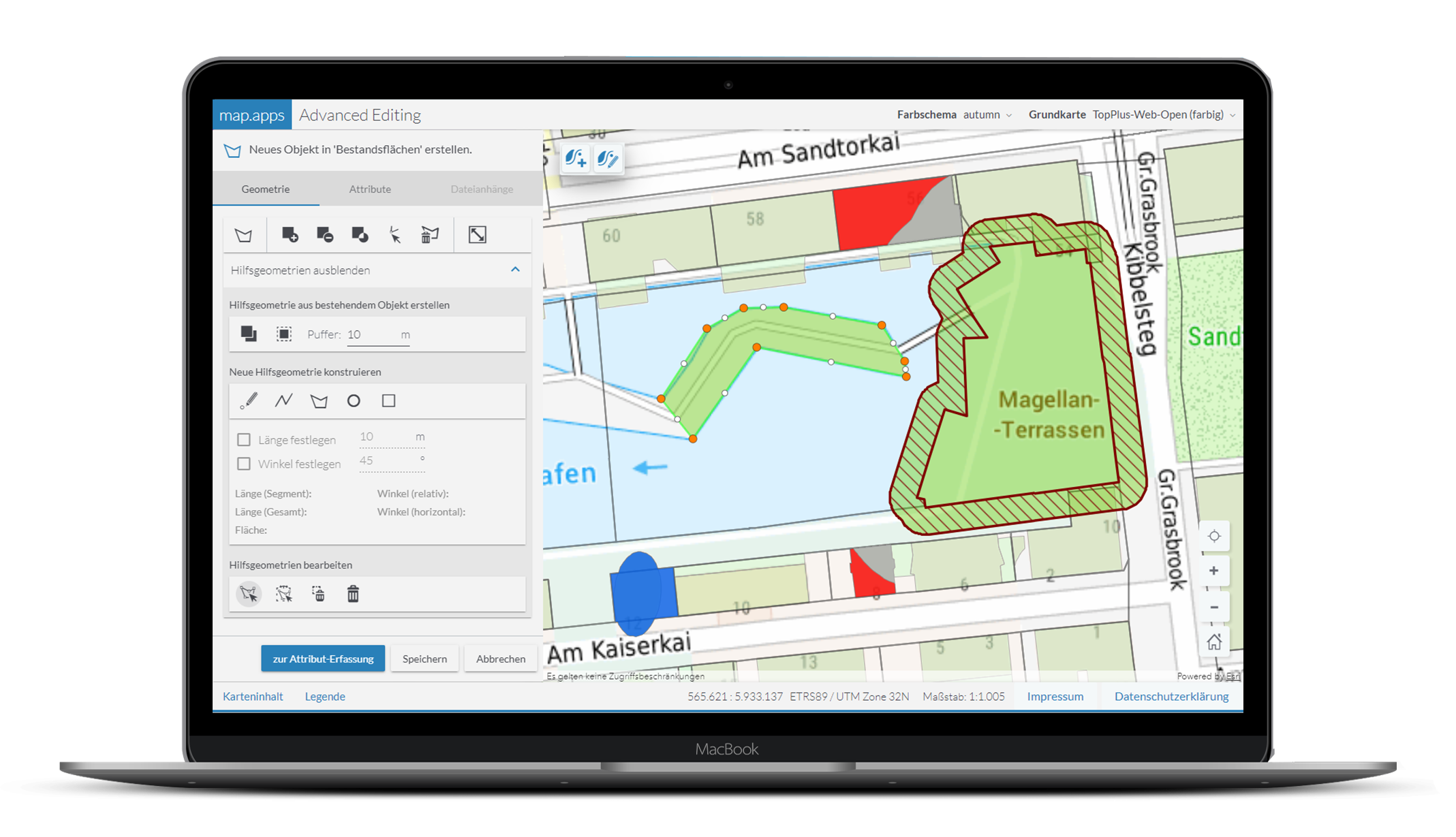
To create a new object, existing geometries of existing geodata can be taken over, combined or clipped. Defined distances to other objects are easily implemented by means of integrated buffer functions. Specific measurements, such as length or angle specifications, can also be easily implemented with Advanced Editing.
The integrated snapping functionality simplifies and accelerates the acquisition process by enabling new acquisition using existing geometries. Object geometries of layers that are relevant for the new capture are already highlighted when the mouse is moved over them and can then be completely adopted for the new object. Partial adoption of points or line sections is also possible when digitising new objects.
As a result, new objects are created whose geometries are based exactly on the underlying data in terms of content, without the possibility of errors.
Especially when capturing surfaces, further possibilities are available through the blending of the differently generated geometries together with “helper” auxiliary geometries.
Intuitive attribute data editing
The acquisition of attribute information is also optimised by use of this extension. This already starts with the possible reduction of attribute data elements to be displayed to those attributes actually required for capture. These can then be freely grouped into meaningful sections, providing an editing workflow that tightly matches the subject matter.
Corresponding to the different attribute types, suitable input widgets are also available in the data entry interface, which facilitate data entry, e.g. via selection templates.
Efficiency and economy
map.apps Advanced Editing enables the transfer of typical data collection workflows to the web browser. The cost-intensive provision and maintenance of data capture software on the users' desktop workstations thus becomes unnecessary. In this way, the extension contributes to the development of cost-effective geoIT solutions.
Performance profile
Efficient acquisition and editing of even complex geodata in the web browser
High user-friendliness through focused editing workflows
Extensive functionalities for geometry editing
- Adoption and intersection of existing geometries from other layers
- Comprehensive snapping functionalities for consistent and error-free geometry capture
- Object-defined buffer functionality (inside / outside)
- Segment capture using length and angle measurements
Flexible attribute editor with intuitive input options
Convenient management of attachments
Barry Masterson